Wellhead Protection Program

Basic Steps to Wellhead Protection
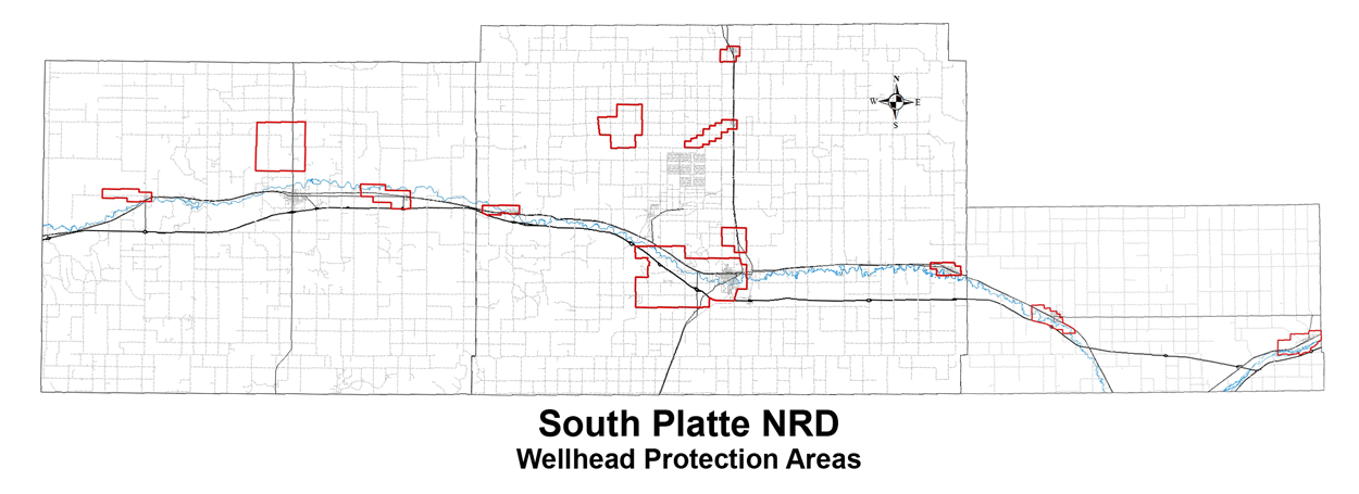
Develop a Wellhead Protection Area map for the public wells of a community.
The Nebraska Department of Environmental Quality and the Nebraska Rural Water Association will draw these maps for a community free of charge. The maps show the specific area around a well or well field that needs to be protected, and the threats that may be a risk to groundwater quality. Maps for communities in the district already participating in the program are listed below.
Identify Potential Contaminants and Sources. This is otherwise known as a contaminant source inventory, in which potential sources of groundwater contamination are identified, along with possible activities that could pollute the public wells.
Manage the Protection Area. This is the main step of an effective wellhead protection program. This can include local or county ordinances or zoning, closing abandoned wells through the South Platte NRD Well Abandonment Program, and working with the NRD to place best management practices on agricultural land in the protected area.
Develop Emergency and Contingency Plans. Plan ahead for possible well failure due to contamination, natural disaster, mechanical problems, etc. The plans should provide for both short and long-term needs.
Plan ahead for new wells. New wells may eventually be needed as a community grows or as wells age. Decision making in a non-emergency setting will be easier than trying to plan in a crisis situation.
Educate and involve the public. Public awareness and involvement is vital to make the whole process work.